Location
Country Profile
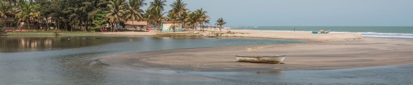
 Geographical Location
The Gambia (officially the Republic of The Gambia) is located in Western Africa and occupies an area of 11,365 sq km. A small sub-tropical country In West Africa, between latitudes 13º28W and 16º36W, it is bordered to the north, south and east by Senegal and has an 80km coast on the Atlantic Ocean to the west. The country’s borders roughly correspond with the path of the River Gambia. The capital city is Banjul and is on Greenwich Mean Time (GMT)
Climate
The Gambia has a sub-tropical climate with two variations of distinct dry and rainy seasons. The dry season commonly known as ‘Harmattan’ usually starts mid-October and ends around mid-June every year with an average temperature of 32°C / 89.6°F. The rainy season usually starts around the mid- June and ends around the mid-October with August being the wettest month of the year, temperatures can reach up to 41°C/105.8°C.
Land
The republic of the Gambia has a total area: 11,365 km2 (4388 sq. miles) and out of this approximately 1,300 km2 is of water bodies with a 80 km coastline with an exclusive fishing zone of 200 nautical miles with continental shelf. The agricultural land is 6,550 km2 and the arable land is 588,000 hectares of which 334,000 hectares are under cultivation and a forest area of 4750 km2 i.e. 47.5% of land area.
The People
The official language of the country is English and the different local languages are Mandinka, Wollof, Fula, Jola, Sarahule, Serere, Manjago and Creole (krio). The Republic of the Gambia’s constitution guarantees freedom of religion. Christianity, Islam and Traditional Religion are the major faiths practiced in the country with the following representation: Christianity (8%), Islam (90%) and traditional religion (2%). The total population of the Gambia according to the 2013 Nation Census was estimated at 1,882,450 inhabitants with average annual growth rate of 3.3%. The population distributions by administrative regions by numbers and percentages are as follows:
The Population
*LGA: Local Government Area
| LGA* | Population | Percentage share of Total Population | ||
|---|---|---|---|---|
| 2003 | 2013 | 2003 | 2013 | |
| Banjul | 35,061 | 31,301 | 2.6 | 1.7 |
| Kanifing | 322,735 | 382,096 | 23.7 | 20.3 |
| Brikama | 389,594 | 699,704 | 28.6 | 37.2 |
| Mansakonko | 72,167 | 82,361 | 5.3 | 4.4 |
| Kerewan | 172,835 | 221,054 | 12.7 | 11.7 |
| Kuntaur | 78,491 | 99,108 | 5.8 | 5.3 |
| Janjangbureh | 107,212 | 126,910 | 7.9 | 6.7 |
| Basse | 182,586 | 239,916 | 13.4 | 12.7 |
| Total | 1,360,681 | 1,882,450 | 100.0 | 100.0 |
Population as at 2016 (UN estimates) 2.1million
Administrative Regions
- Central River Region
- Lower River Region
- North Bank Region
- Upper River Region
- West Coast Region
Historical Background
The first written accounts of the region come from Arab traders in the 9th and 10th century. Arab traders established the trans-Saharan trade routes. The Portuguese took control of The Gambia and benefited greatly from the maritime routes. The Gambia was briefly under Polish-Lithuanian rule from 1651 until the River Gambia was ceded to Great Britain under the 1783 Treaty of Versailles.
The Gambia was under British colonial rule from 1816 and served as a strategic enclave against French influence in the sub-Saharan region.
The Gambia achieved independence on February 18, 1965 from the United Kingdom. In 1970, The Gambia became a republic within the Commonwealth, following a second referendum, with Prime Minister Sir Dawda Kairaba Jawara, as Head of State. The Gambia was led by President Jawara, who was re-elected five times.
In July 1994, Yahya A.J.J. Jammeh came into power following a peaceful military coup d'état. Elections were held in 1996 declaring retired colonel Yahya A.J.J. Jammeh as the civilian President of the Second Republic and then sworn into office November 6th, 1996. President Alhagie Yahya A.J.J. Jammeh has remained in office after winning three consecutive elections in 2001, 2006 and 2011 respectively.
In December 2016, elections were held declaring Adama Barrow as the civilian President of the Third Republic and then sworn into office January 19th, 2017. Today, The Gambia remains stable, peaceful and democratic, the economy is picking up slightly and all the sectors within the economy are thriving.
Exchange Rate
US$1=GMD49.50 (Febuary 2019). Visit the Central Bank for the latest exchange rates.
Infrastructure
There continues to be sustained improvement in basic infrastructure, including the notably expansion of the Road Network, Telecommunication System, Seaport and Airport and the Electricity System.
Sea Transport
The Port of Banjul is the main seaport that serves The Gambia's seaborne trade and is one of the World's busiest Shipping lanes. It is situated at latitude 13 degrees 27' North and Longitude 16 degrees 34' West and located on the estuary of the River Gambia, 26 nautical miles away from the Atlantic Ocean. The river can be navigated up to 300 miles inland by sea-going vessels and further still by commercial barges, providing a cost-effective and reliable alternative to road transport. The Port has a deep sheltered anchorage with no record of piracy and is internationally recognised as one of the safest and most efficient ports in West Africa. It offers a prompt, reliable and value-for-money service. The port’s well developed facilities can handle any type of cargo, while its infrastructure, competitive tariffs, use of information technology and dedicated professional workforce ensure that the customer is always provided with the highest quality of service.
Air Transport
The Banjul International Airport is regulated by the Gambia Civil Aviation Authority which is a member of ICAO and follows their regulations and guidelines. The airport can handle up to one million passengers a year and has open skies agreements with the United States and EU Countries and is certified as a last point of departure to the U.S. by FAA. There are direct flights from Banjul to London and Brussels and other major world destinations such as the US, Frankfurt, Hong Kong, Taiwan, Japan, and South Africa can be reached via London and Brussels or via Dakar which is 20-25 minutes by air from Banjul. The airport has undertaken a significant transformation despite being faced with a competitive air transport market and considerable growth in air traffic demand. The Authority continues to invest heavily on human capital, equipment, airport infrastructure and safety as stipulated in the ICAO Convention and Technical Annexes.
Energy
The Government of The Gambia has put in place a national energy policy, a national energy strategy as well as national renewable energy law and feed-in tariff that is geared towards opening the renewable energy sector for enhanced private sector investment. The National Water and Electricity Company Limited (NAWEC) a Government incorporated limited liability company responsible for the production, transmission and distribution of water, electricity and sewerage services in The Gambia. The electricity supply system in The Gambia comprises of an integrated Transmission and Distribution System in the Greater Banjul Area, and six standalone grids in the rural areas. NAWEC is committed to expanding its coverage and aims at increasing the installed capacity to at least 180 Megawatts by 2020.
Currently, there is an Independent Power Producer (IPP) which has an installed capacity of 25 megawatts and is significantly contributing to NAWEC’s generation capacity. Most recently, there has been a granting of another licence to the village of Batukunku to generate wind energy. This project marks a milestone in the history of this country and demonstrates that alternative sources of energy can be a reality. The new wind turbine has a capacity of 150KW which though small will help to boaster NAWEC’s generation.
Telecommunications
A digital telephone system has been available in The Gambia since 1986, and the State owned Gambia Telecommunications Company (GAMTEL) maintains a satellite earth station at Abuko, not far from the airport with direct links to Europe and the US and links to other countries via the UK and France. Land links to Europe are also available through Senegal.
ASDL and IP-VPN are available to corporate customers
This sector has witnessed the establishment of four GSM mobile operators, one fixed network operator and more then six ISP licenses. In August 2008, a 3G license was issued as the fourth entrant into the mobile market.
The telephone penetration level (tele-density) measured as the percentage of the population owning a fixed and or mobile service has been very impressive the years, registering 21.59%, 54.47% and 76% in, 2006, 2007 and 2008 respectively. This impressive performance in the penetrations level is as a result of the strong performance registered in the mobile subscriber base. The mobile penetration level has increased from 51.4 in 2007 to 72.9 in 2008, whilst the fixed line penetration level been steadily dropping from 2006.
Mobile charges
Please visit The Public Utilities Regulatory Authority: www.pura.gm
Gambia Investment And Export Promotion Agency
48 Kairaba Avenue, Serrekunda, K.S.M.D P.O. Box 757, Banjul
The Gambia
Tel: (00220) 4377377 / 4377378 / 4377623
Fax: (00220) 4377379
Email: info@giepa.gm
Website: www.giepa.gm